REVIEW · LA PALMA
La Palma: Guided trekking tour to volcanoes south
Book on GetYourGuide →Operated by La Palma Transfer & Tours · Bookable on GetYourGuide
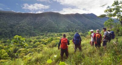
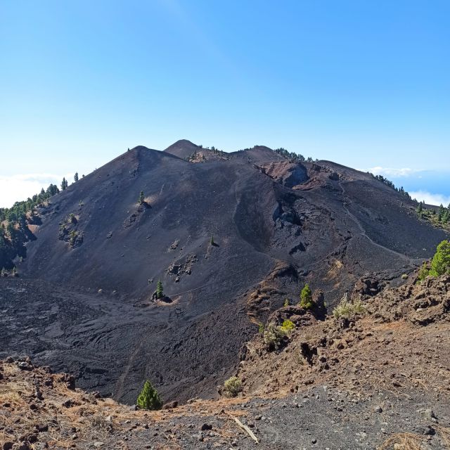
Mars-like volcanoes, but with real sea views. This guided hike takes you along the Volcanoes Route, starting at Refugio de El Pilar and placing you right in the Cumbre Vieja volcanic zone. I love how the guide explains lava, ash, calderas, and eruptions while you walk through the youngest crater area.
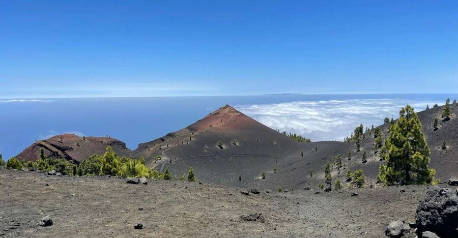
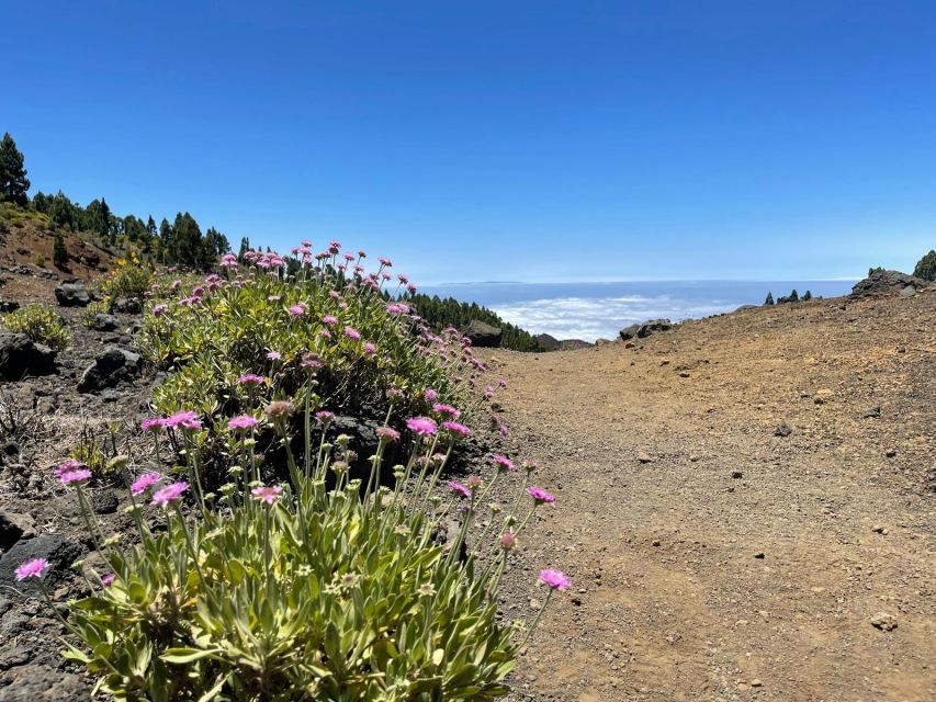
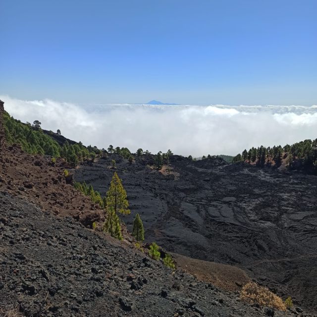
I also love the photo payoff: the pine-green slopes, the black-and-red volcanic terrain, and clear-day views toward Tenerife, La Gomera, and El Hierro. Depending on conditions, you may even get that surreal walk through clouds, like the island is wearing a white “sea” blanket.
One thing to plan for is that this is a tough 17 km trek with real climbing and a demanding descent, so you need good physical condition and comfortable, grippy footwear. It’s an 8-hour outing, and you’ll feel it most on the way down.
In This Review
- Key things to know before you go
- Starting at Refugio de El Pilar: where the climb really begins
- GR-131 through the pine-and-volcano transition on the island’s youngest zone
- The Hoyo Negro crater section: where the clouds can steal the show
- Las Deseadas and the long descent: when legs work harder than your brain
- Arriving at Los Canarios (Fuencaliente): finish strong, camera ready
- Why the guide talk matters on a volcano route (and what you’ll hear)
- Pace, timing, and the reality of an 8-hour day
- What to bring when food and drinks aren’t included
- Value check: is about $50 worth it?
- Should you book the Volcanoes Route south trek?
- FAQ
- FAQ
- How long is the guided trekking tour?
- Where does the hike start?
- How far is the hike?
- How high do you go?
- Is the route easy?
- What’s included in the price?
- Are food and drinks included?
- What languages is the guide available in?
- Can I see other islands from the hike?
- What’s the final stop before the transfer back?
Key things to know before you go
- 17 km from Refugio El Pilar to Los Canarios (Fuencaliente): a full-day effort, not a casual stroll
- GR-131 trail with big viewpoints built into the hike: from Pico Birigoyo-area panoramas to crater stops
- Hoyo Negro crater plus a possible cloud-sea moment: one of the most striking visual sections on the route
- A high point at Las Deseadas, then a tougher descent: legs get tested after the summit feel
- Volcán de Martín’s reddish cone near the finish: great final “wow” before Los Canarios
- Hotel pickup/drop-off and small-group guidance: Spanish, English, and German-speaking guides
Starting at Refugio de El Pilar: where the climb really begins
Your day starts at Refugio El Pilar, the launching point for one of La Palma’s most popular volcanic routes. You’ll begin on the GR-131 trail, and pretty quickly the path tilts uphill. That early push matters, because it sets the pace for the day: you’re climbing into a landscape shaped by eruptions, not just walking across it.
What I like about starting here is how the route gives you viewpoints as motivation. After the initial climb that skirts the Pico Birigoyo area, the views open up across key parts of La Palma. You can look out toward the Aridane Valley and see the Caldera de Taburiente in the distance, with Roque de Los Muchachos hanging in the background.
Practical tip: this isn’t the kind of hike where you can stroll at the start and make up time later. If your fitness is good, you’ll settle into the rhythm. If it’s not, the uphill sections can sap energy before you ever reach the craters.
You can also read our reviews of more tours and experiences in La Palma.
GR-131 through the pine-and-volcano transition on the island’s youngest zone
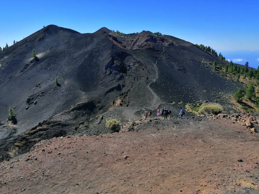
As the route climbs, you’ll move along trail sections where the island’s look shifts in a way that’s easy to appreciate while you’re walking. You’ll pass between Canary Island pines, while volcanic ground shows up around and beneath you with ash-dark tones and sharper volcanic forms.
This is also where the guide’s explanations help most. You’re crossing a younger stretch of the island formed by several volcanoes, part of the Cumbre Vieja Natural Park. The talk isn’t just random facts; it’s tied to what you’re literally stepping through—lava fields, ash deposits, and volcanic structures like calderas.
There’s also a “from-both-sides” feeling to the route. From higher points, you’ll get glimpses of different municipalities—El Paso, Los Llanos de Aridane, and Tazacorte can come into view depending on where the trail puts you. It’s a reminder that this is not a distant nature exhibit. It’s an active geography that still shapes where people live.
On a clear day, you might even see the neighboring islands—Tenerife, La Gomera, and El Hierro. That visibility doesn’t happen every time, but when it does, it turns the trek into one big aerial postcard.
The Hoyo Negro crater section: where the clouds can steal the show
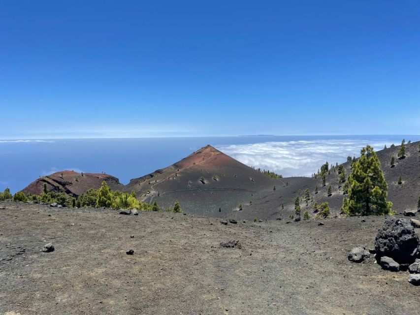
At Hoyo Negro, the hike steps into one of its most memorable phases. You reach the crater area, and that’s important because this is where the route starts to feel like a chain of volcanic “chapters.” Hoyo Negro marks the beginning of the many craters you’ll find along the Volcanoes Route.
Then there’s the mood shift that can happen here: depending on the day, you may walk through clouds. The guide’s route description often highlights it as a blanket-like sea of white. In plain terms, it can feel like you’re moving along the edge of the world—ground underfoot, visibility turning soft, and the island’s depth disappearing and reappearing as the cloud layer changes.
If you’re a photographer, this is a section to treat like a gift you can’t predict. Don’t just shoot wide panoramas; also look for the textures that clouds amplify: darker volcanic rock against pale cloud, and pine silhouettes cutting through mist.
What to watch for: if visibility drops, slow down. The volcanic terrain and crater-edge areas can be uneven, and your footing becomes the real priority.
Las Deseadas and the long descent: when legs work harder than your brain
After you reach Las Deseadas, the highest point along the route, the day changes. Up to that point, you’ve been collecting views and geological explanations. After Las Deseadas, you’re in descent mode—and the descent is described as difficult.
This is a key reality check before you book: you’re not just “hiking 17 km.” You’re doing a climb plus a tough downhill, which is harder on knees and thighs than most people expect. The guide helps keep you on track, but the physics are the physics.
During the descent, you’ll reach Volcán de Martín, one of the last craters you’ll see before reaching the finish. It’s known for an impressive reddish cone, the kind of shape that pulls your eyes even if you’re tired. It also makes a great target for photos because you can frame it against the pale sky, pines, or cloud layer depending on conditions.
Then, little by little, the trail leads you toward Los Canarios (Fuencaliente), your final guided stop. The transfer back is waiting there, so you’re not left solving logistics while exhausted.
Arriving at Los Canarios (Fuencaliente): finish strong, camera ready
The endpoint is Los Canarios (Fuencaliente), the southernmost municipality on the island. This is where the route ties together: volcanic craters and cones, pine pockets, and wide views across La Palma and beyond.
It’s also where the emotional payoff lands. The tour notes promise that you’ll take pictures you’ll never forget—and honestly, even if you’re not a “professional photo” person, you’ll likely want a few shots just to prove you were there. The route has that Mars-on-Earth vibe, with volcanic terrain that looks too strange to be real.
The day ends with the transfer back to your starting point. That’s a big deal. It keeps the experience focused: you hike the Volcanoes Route, you don’t also have to plan a second transport step after your legs are cooked.
Why the guide talk matters on a volcano route (and what you’ll hear)
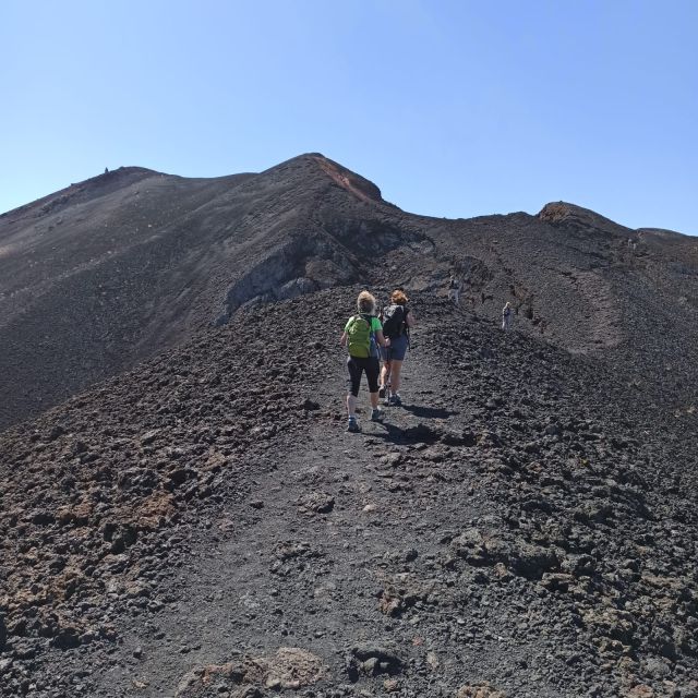
A guided volcano hike is only half walking. The other half is understanding what you’re seeing as the terrain changes.
Here, the guide connects the scenery to the story of volcanism. You’ll hear about volcanic eruptions, and how lava, ashes, and calderas create what you see along the trail. As you move across the youngest volcanic area in the Cumbre Vieja park zone, the explanations help you stop treating everything like a generic “cool rock.”
This is also where communication matters. This tour runs with live guidance in Spanish, English, and German, and the group stays small. One guide name that comes up in the experience is Arnie, and the standout point is how well the guide pairs route leadership with volcanic context so you don’t just follow—you understand.
If you like hiking with a purpose, this is a good match. If you prefer silence and minimal talking, you’ll still get the basics, but you’ll likely enjoy the time more if you’re willing to listen for short moments between viewpoints.
Pace, timing, and the reality of an 8-hour day
The tour runs for 8 hours, and that’s a realistic time window for a tough route. The distance is about 17 km, and it includes uphill climbing and a tough descent. So plan your day like it’s your main activity, not an add-on.
Because it’s a guided route, you’ll benefit from group organization and navigation support. The tour also offers small group options, which usually helps with safety and staying together on uneven terrain.
One pacing tip that keeps things enjoyable: don’t sprint early. Instead, keep a steady effort on the climb so you can handle the descent later. The highest point feeling at Las Deseadas is not the finish line—it’s when legs start to feel like they’re doing double duty.
Also, keep an eye on your energy for crater areas. They tend to be the spots where people naturally stop for photos longer than planned. That’s fine if you manage it gently, but it can add time if everyone lingers at once.
What to bring when food and drinks aren’t included
Food and drinks are not included, so bring what you need to keep yourself steady across 8 hours. I’d treat this as a trail-day setup:
- Water you can actually carry comfortably
- Snacks you can eat without needing a full meal setup
- Sun protection (even on cloudier days, higher altitude can still mean strong light)
- Layers (cloud cover can change how warm you feel quickly)
- Sturdy hiking shoes with grip for volcanic and possibly uneven footing
- A camera, or at least your phone battery charged, because the crater views and cone shape at Volcán de Martín are photo magnets
Because this route can include cloud cover, having a light outer layer can save you from feeling chilled when visibility drops.
Value check: is about $50 worth it?
At $50 per person for an 8-hour guided trek, the value is mostly in what’s included: hotel pickup and drop-off, plus a live guide.
For a volcano route, that combination matters. Pickup reduces time wasted figuring out where to start, and the guide reduces “I’m not sure what I’m looking at” frustration. Instead of walking a famous path and guessing the geology, you get the explanation while you’re standing in front of it—lava, ash, calderas, and the youngest crater zones.
The one cost that’s easy to underestimate is the “outside the booking” part: no food and drinks. If you plan your snacks and water before you go, that’s a minor issue. If you show up hungry, it can make a tough descent even tougher.
Also, the tour has a strong track record, with an average rating of 4.9 from 44 reviews. I treat that as a signal that people generally feel the experience matches what they paid for, especially the guidance and the way transport is handled.
Should you book the Volcanoes Route south trek?
Book this tour if you want a real hike with geology context, not just a scenic walk. It’s a great fit if you enjoy understanding how landscapes form and you don’t mind a tough day that ends with your legs working harder than your curiosity.
I’d pass (or rethink) if you don’t handle long descents well, because the route is described as tough and includes both climbing and a challenging downhill after Las Deseadas. You should also be ready for the fact that fuel stops aren’t part of the package, since food and drinks aren’t included.
If you’re the type who likes Mars-like volcanic terrain on Earth—and you want the guide to connect what you see to volcanism—you’ll likely love this day on La Palma.
FAQ
FAQ
How long is the guided trekking tour?
The tour lasts about 8 hours.
Where does the hike start?
The start is at Refugio El Pilar. The meeting point can vary depending on the option booked, but the hike begins from there.
How far is the hike?
The route is about 17 km.
How high do you go?
The hike takes you to almost 2,000 meters above sea level to the final point.
Is the route easy?
No. It’s considered tough, and you should have good physical condition to complete it.
What’s included in the price?
Hotel pick-up and drop-off and a live guide are included.
Are food and drinks included?
No. Food and drinks are not included.
What languages is the guide available in?
The live guide is available in Spanish, English, and German.
Can I see other islands from the hike?
On clear days, you may be able to see Tenerife, La Gomera, and El Hierro.
What’s the final stop before the transfer back?
The hike finishes at Los Canarios (Fuencaliente), and then the transfer back to the starting point is waiting for you.