REVIEW · PRAIA
Santiago: Longueira, Pico de Antónia & Monte Tchota Trek
Book on GetYourGuide →Operated by Bu Country Tours · Bookable on GetYourGuide
Pico de Antónia gets your attention fast. I love how this trek mixes serious uphill climbing with real local moments in Longueira, including time at a rum distillery and community spots; then you get rewarded with big views that can reach as far as Maio Island and the volcano on Fogo. The possible drawback: this is not a casual walk—one route option is rated very difficult, with steep, narrow trail and lots of elevation change.
I also appreciate that the guiding feels personal rather than “just walking in a line.” Guides like Djibril, Ricardo, and Admilson Garcia stand out for being friendly, attentive, and tuned to the route, plus they help when the ground gets slippery. If you go, plan on bringing the right gear and taking the climb step by step.
In This Review
- Key reasons this Santiago trek earns its reputation
- From Praia to Longueira: where the day starts with people, not just trails
- Grogue rum, the primary school, and Lemba Lemba Bar: more than a quick photo stop
- Pico de Antónia climb: steep effort, big payoffs, and the “victory” feeling
- Where the views come from (and what you should watch for)
- Monte Tchota/Txota natural park: finishing with intact nature and quieter momentum
- Route options, trail reality, and how to avoid a sore-day mistake
- What’s included, and how the value adds up at $106
- The guides: how friendliness and expertise show up on the trail
- Packing list that matches the terrain
- Should you book the Santiago: Longueira, Pico de Antónia & Monte Tchota Trek?
- FAQ
- FAQ
- How long is the trek?
- Is the trek difficult?
- What elevation will I reach?
- Where does the tour start and end?
- What’s included in the price?
- What should I bring?
Key reasons this Santiago trek earns its reputation
- Longueira village access: rum culture plus small community stops like the primary school and Lemba Lemba Bar
- Two Pico de Antónia difficulty options: a shorter harder day or a longer, higher-gain challenge
- Real altitude and steep sections: expect the last meters to feel steep, especially near the top
- Monte Tchota/Txota natural park: quiet nature time focused on fauna, flora, and birds
- Guides who help you move: walking sticks support on slippery returns, with kind, professional coaching
From Praia to Longueira: where the day starts with people, not just trails
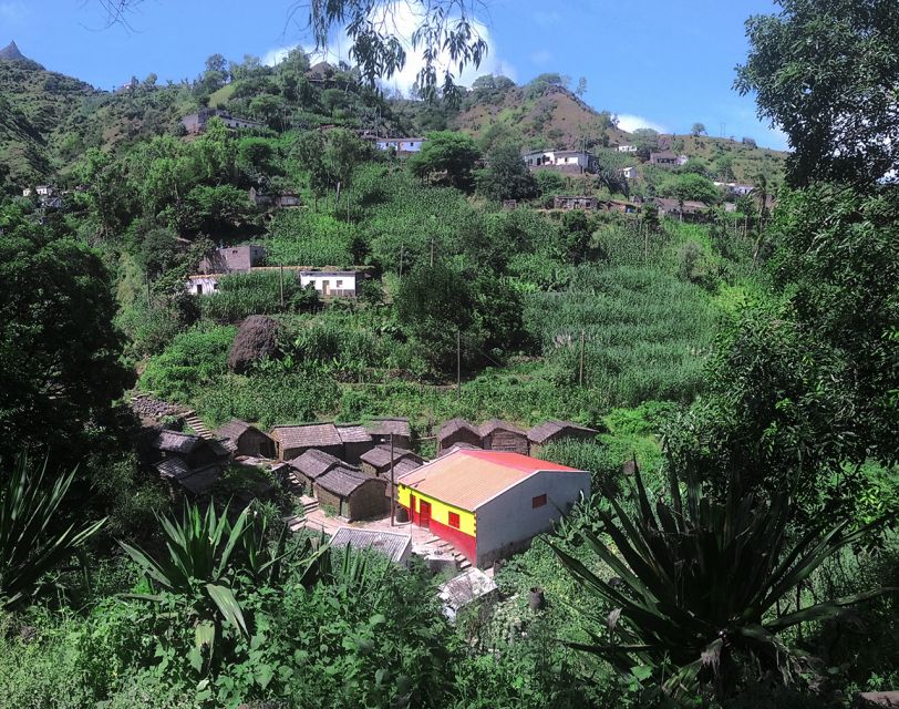
Most days on Santiago begin with ocean air in Praia, then this tour quickly shifts you into the island’s inland rhythm. You’ll get hotel pickup in Praia, travel to the village of Longueira, and settle into a slower pace before the hiking starts. That matters because it makes the climb feel earned, not rushed.
Longueira is where you meet the human side of Santiago. You’re not just passing through; you’re encouraged to connect—direct contact with locals is a core part of the experience. It’s the kind of stop that changes how you view the rest of the day, because the mountains suddenly feel like they belong to a lived-in world.
One more reason I like the pacing: you’re given time to refuel and reframe your effort before you tackle the steep sections of Pico de Antónia. It’s a better setup than starting straight from sea level and hoping your legs magically cooperate.
You can also read our reviews of more tours and experiences in Praia.
Grogue rum, the primary school, and Lemba Lemba Bar: more than a quick photo stop
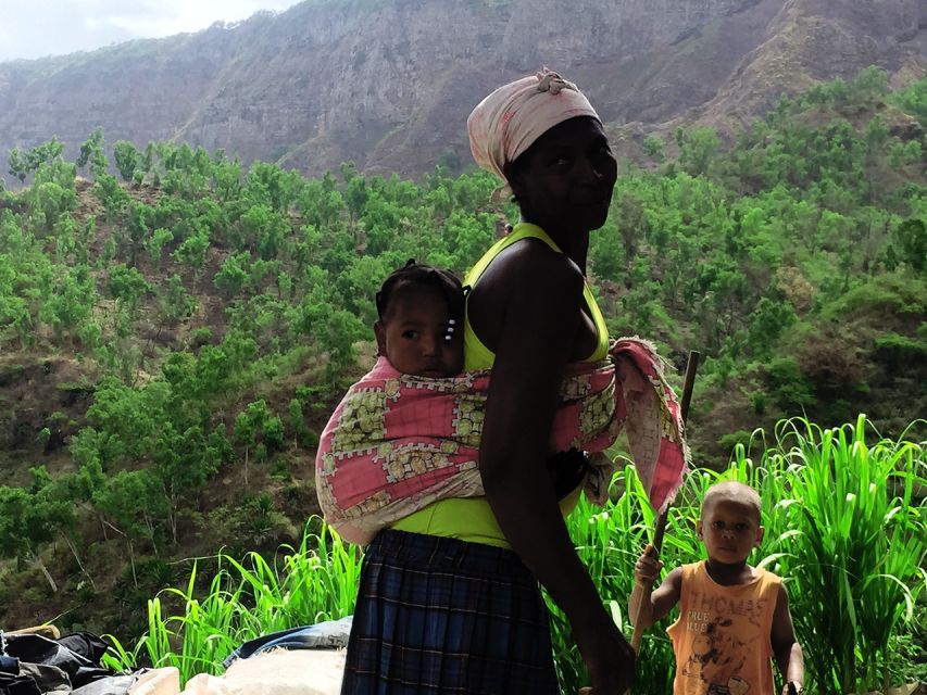
In Longueira, the tour includes a visit to the Grogue Distillery, plus time at the primary school and Lemba Lemba Bar. Even if you’re not a rum expert, this is the value: you see everyday culture tied to something made locally, not a staged performance for tourists. It’s also a chance to ask questions and understand what locals think is worth sharing.
At the distillery, you get the sense of a community that treats alcohol production as craft and tradition, not an industrial process. And because the tour also stops at places like the school, you’re getting context rather than a single-interest detour.
If you’re wondering what to do with your camera, this is where you’ll get your simplest shots: people, hands at work, and the small-scale feel of the village. The best photos often happen when you slow down and let the guide introduce you to what you’re seeing.
Pico de Antónia climb: steep effort, big payoffs, and the “victory” feeling
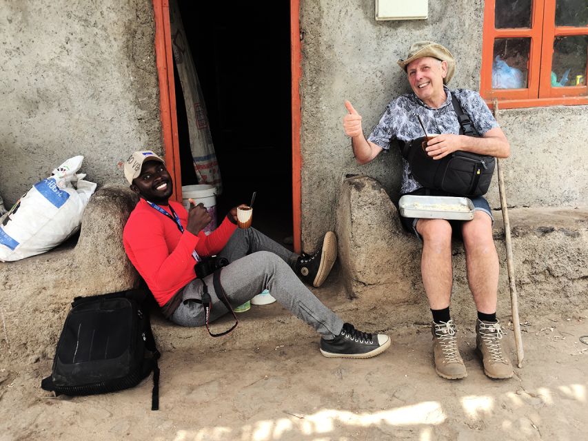
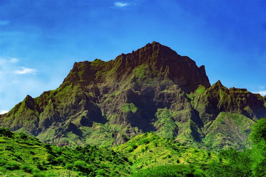
The heart of the day is the climb to Pico de Antónia, the island’s highest point. From the walking point near 1394 meters, you’re set up for wide views over the São Jorge Valley. On clear days, you might catch Maio Island and the volcano on Fogo Island, which is a pretty special bonus because it turns a local climb into a multi-island perspective.
The trek involves a serious ascent. For one route option, you’re looking at about 5 hours uphill, with a stop for a small picnic and views along the way. The effort is real: you’ll gain roughly 1050 m (and the route goes down too), and you’ll be hiking around 9 km total with about 6 hours of walking time. That’s the “very difficult” option, and it’s the one where the last meters can feel steep enough to make you earn that top-of-the-world grin.
Even if you choose the other route option, don’t assume it’s easy. The difficult option is about 4 hours total walking and roughly 6 km, with around 585 m gain. The climb still has a vertical bite, and it stays on narrow, tilty paths. The difference is more about duration and overall elevation work than about whether it’s steep.
A practical note that I’d treat as non-negotiable: shoes matter a lot here. The trail is described as narrow with a tilty feel, and the descent can get very slippery. In the same way that stepping into a bus doesn’t train you for hiking, slipping on a narrow trail doesn’t forgive poor footwear. Plan accordingly.
Where the views come from (and what you should watch for)
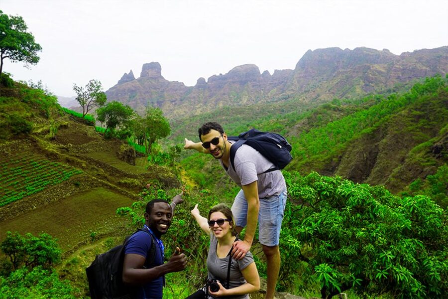
As you hike, the route is designed to reward attention. The tour highlights the possibility of seeing Maio Island and the Fogo volcano from the high viewpoint area, but it also focuses on what’s happening closer to your feet. You’re likely to be on the lookout for endemic plants, animals, and some bird species in danger of extinction.
That’s more than a nature-lecture add-on. It helps you pace yourself mentally. Instead of only staring at the next switchback, you can break the hike into “mini moments”: a plant you’ve never seen before, a bird sighting, or a view angle that changes every few minutes. It also makes the stop for a picnic more meaningful, because you’re not just eating while resting—you’re resetting your observation skills.
Photo-wise, this is a day for strategic framing. Bring enough water and don’t treat the camera like a substitute for balance. When you stop for photos on steep, narrow sections, plant your feet first, then shoot. The views are worth it; so is not taking a tumble.
Monte Tchota/Txota natural park: finishing with intact nature and quieter momentum
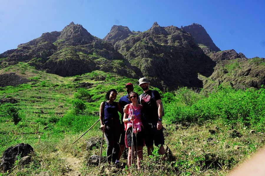
After Pico de Antónia, the tour finishes in the Monte Tchota/Txota natural park. This is where the vibe shifts from effort-driven climbing to a more observant walk in an area valued for its intact nature and for supporting different kinds of fauna and flora.
I like this structure because it prevents the day from becoming only “up, then down.” The park ending gives you a chance to absorb what the climb actually bought you: context. You’re not just hiking a high point; you’re moving through different ecological zones across Santiago, and you end in a place that’s about preservation.
If you’re bird-focused, this is one of the best parts of the day. The tour specifically points to bird species that are at risk, and a good guide will help you look calmly rather than chase movement. Even when you don’t spot something, you still get a stronger feel for the ecosystem simply by slowing down.
Route options, trail reality, and how to avoid a sore-day mistake

This tour gives you two route options, and you should pick based on your hiking style—not just your courage.
Option 1 (very difficult) runs about 9 km with roughly 6 hours of walking. You’ll gain about 1050 m and lose about 600 m, with a maximum elevation around 1390 m. That’s a lot of vertical work, and it fits hikers who are comfortable with steep climbs and narrow trails.
Option 2 (difficult) is about 6 km, roughly 4 hours total walking, with around 585 m gain and 186 m loss. Max elevation is listed around 1160 m. This still asks for steady effort, but it’s more manageable if you want the key highlights without as much elevation punishment.
Path quality is described as tilty, narrow, and the route is one-way. One-way trekking is part of the challenge because you can’t “even it out” mentally halfway; you commit to the direction and adjust your pace rather than expect a gentle reset.
I’d also plan for that slippery descent. The climb can feel like pure stamina work; the return can turn into careful-footing work. Guides have been known to provide walking sticks, which is a big deal on slick patches, especially when your quads are tired.
What’s included, and how the value adds up at $106
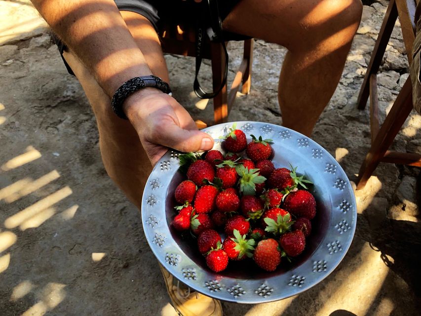
The price is listed at $106 per person, and what you’re paying for is more than a guided hike. You’re getting pickup and drop-off at your accommodation in Praia, plus transportation, a tour guide, and a picnic (soft juice, sandwich, fruit). You also get liability insurance.
For me, the best value pieces are the ones that cost time and coordination if you try to DIY: getting from Praia to Longueira, having a guide for Pico de Antónia, and finishing in Monte Tchota/Txota rather than turning the day into “I hope I find the right trail.” The local access in Longueira—rum distillery, school area, and Lemba Lemba Bar—also can’t be replicated without local connections.
Also, the tour is guided in multiple languages: Spanish, English, French, and Portuguese. That’s practical for mixed groups and helps you actually understand what you’re seeing, instead of guessing.
The guides: how friendliness and expertise show up on the trail
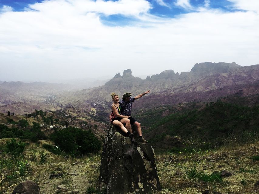
The guides are one of the strongest reasons to book this. You’ll meet different guide names depending on the day, but the vibe is consistent: kind, attentive, and clearly used to the route.
Djibril has been described as professional, jovial, and respectful, with a strong focus on how the hike is organized and how you handle the trail from start to finish. Ricardo is another name you may see, noted for being kind and friendly. Admilson Garcia is mentioned for knowing the region very well—so well that it feels like he knows people and story-lines throughout the area.
And the “help when it matters” part is real. When the return is slippery, guides provide advice and sometimes walking sticks, which you’ll be grateful for after a steep climb. That’s the difference between hiking and safely navigating a narrow mountain trail.
Packing list that matches the terrain
The tour’s basic packing list is exactly what you should follow:
- Hat
- Hiking shoes
- Sunscreen
- Water
I’d add one more practical rule: wear hiking pants, especially from August to November (that’s when the tour strongly advises it). And while walking sticks aren’t listed as mandatory, they’re highly recommended, which lines up with what people report when the ground gets slick.
If you’re tempted to go light—good for your bag, bad for your footing. This hike involves steep climbs, elevation change, and narrow trail sections. Give yourself the tools to move confidently.
Should you book the Santiago: Longueira, Pico de Antónia & Monte Tchota Trek?
If you want an experience that mixes local village culture with a real mountain workout, this is a strong pick. I’d especially recommend it if you care about meeting locals beyond a quick handshake, and if you like hikes where the guide helps you see nature (endemic plants, fauna, and possible endangered birds) rather than treating it as background.
You should probably pick the shorter option (the “difficult” route) if you’re fit but don’t want as much elevation gain and time on the trail. If you’re an experienced hiker who enjoys steep effort and doesn’t mind slow, careful footwork on narrow paths, the very difficult option may feel more satisfying.
One last decision tip: choose based on your footwear and your willingness to handle a slippery descent. The views and the sense of victory at the top are absolutely the point—but the way you get back down is what makes the day either smooth or miserable.
FAQ
FAQ
How long is the trek?
There are two route options. One is about +/- 6 hours total walking (about 9 km), and the other is about +/- 4 hours total walking (about 6 km).
Is the trek difficult?
Yes. One option is rated very difficult with about +/- 1050 m elevation gain, and the other is rated difficult with about +/- 585 m elevation gain.
What elevation will I reach?
For one option, the maximum elevation is about +/- 1390 m. For the other, the maximum elevation is about +/- 1160 m.
Where does the tour start and end?
You get pickup and drop-off at your hotel in Praia. The trek starts with travel to the village of Longueira and finishes in the natural park of Monte Tchota/Txota, then you’re dropped back at your hotel in Praia.
What’s included in the price?
Pickup and drop-off, transportation, a tour guide, a picnic (soft juice, sandwich, fruit), and liability insurance are included.
What should I bring?
Bring a hat, hiking shoes, sunscreen, and water. The tour also strongly advises hiking pants, especially from August to November, and walking sticks are highly recommended.